I’m out in Washington State for work right now, and a few weeks back me and a couple climbing acquaintances out of Portland penciled in Easter weekend to make an attempt climbing Mount Hood.
Things were looking doubtful for awhile there with all the snow that was dumping throughout the Cascades, the avy conditions, and the general weather pattern, but somehow, someway, there was a high pressure system forecasted to come in over Easter weekend.
We hemmed and hawed over whether to go for a Saturday climb or a Sunday climb. The day before things were looking about the same for either day, with a bigger uncertainty on Easter Sunday, so we penned in a Saturday ascent of Leuthold’s Couloir on the west side of Mt. Hood.
[singlepic id=17 w=540 h=405 float=center]
Friday (4/6) after work I finished packing my gear and made the three hour drive down to Portland, with a quick stop at REI and a food stop at Safeway (and dealing with the terrible traffic), I made it down to Matt’s house in Portland by about 8:30pm.
We chatted for awhile about the route, gear, and overall plan, and then I hit the sack by 10pm. With maybe two hours of actual sleep, I was up at 12:15am for breakfast and we were on the road shortly after 12:30am for the drive to Timberline Lodge.
We met up with Matt’s friend, Jason, at the Timberline parking lot and got geared up in the climber’s lodge, and were able to start our ascent out of the Timberline parking lot shortly before 3am. We effectively had a full moon, and thus never even needed to turn on our headlamps.
For those unfamiliar with Mt. Hood, it is a modestly glaciated peak, standing at 11,249 feet. Timberline Lodge (the beginning point for south side attempts) starts at 6,000 feet. The South Side route does not pose any crevasse hazard along the Palmer Glacier, and actually features a number of ski lifts that bring skiers up to 8,500 feet, and also features a nicely groomed track and a particularly easy handrail for morning navigation.
Guided ascents of Hood also typically include a snow cat ride up to the top of the glacier, however, we’d be hoofing it up alongside the ski lift instead of getting a cat ride. AM temps were about 15 degrees, with no wind.
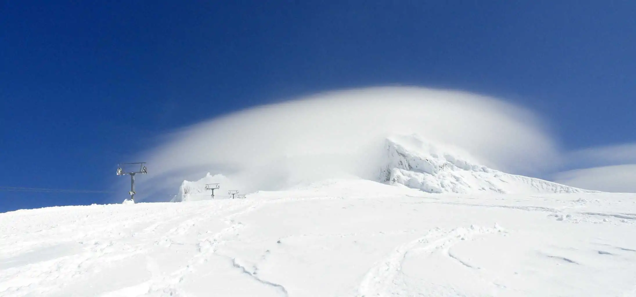
There was a strange cloud parked low over the Palmer, which we had noticed with concern on the drive in, and which persisted for quite awhile. Then suddenly it just dissipated as we hiked up that morning, and we became quite optimistic about the day’s weather.
Up and up along the groomed track beside the lift–past Silcox Hut and eventually reaching the top of the lift (8,500ft)–which was buried to the absolute top, along with a building, I’m told–where we began our traverse to the west toward Illumination Rock. We were following recently laid boot tracks and conditions were pretty good with only a few deep sinks.
Right before reaching Illumination Saddle we encountered a solo climber heading our way–he informed us that he was soloing across the upper Reid Glacier (where we were heading) when he heard a crack (over his headphones) in the snow and saw it shoot 10-15 feet underfoot. At that point he decided to change routes.
We had him take us up to the Saddle and show us where he was. The saddle was extremely windy, with an easterly wind, which could have caused further snow loading across the upper Reid.
None of us really felt inclined to investigate further or risk the traverse across, and so all four of us decided to abandon our planned ascent of Leuthold’s Couloir and instead head for the standard South Side route.
Change of Plans
[singlepic id=21 w=540 h=405 float=center]Traversing across from Illumination Saddle (9,300ft) we rotated through at least one cycle of breaking trail. But it didn’t take too long to reach the standard route. By about this time, dawn started to break over the mountain, and we were able to join the conga line heading up the south side.
Everybody seemed to be moving slower at about this point. I certainly was. The combination of two hours of sleep, with the rapid change from sea level to 10k, and the extra traverse (x2) of the Palmer just to get to the South Side, had slowed my usual pace, I think.
The slow pace allowed one to really look around and enjoy the spectacular rime wonderland that Mount Hood is. The rime coats all the rock and makes some beautiful and intricate patterns and designs that I’ve never really seen before on that scale. We passed a few large parties, and the steaming, volcanic fumaroles, and eventually reached the area just below the Hogsback at 10,600ft, only to arrive in the midst of a whiteout.
[singlepic id=20 w=540 h=405 float=center]At this point we dug out some seats along the ridgeline below the Hogsback and snacked and hydrated. The clouds were thick, and we couldn’t even see the Hogsback anymore. We initially saw a few parties heading up toward the Old Chute, including a large crew of Mazamas, but now it was just white.
The temps were now hovering just below 10 degrees with the sun blocked out. It was quite cold. Especially when stopped. We wanted to wait it out and see if this cloud cover would break.
It was all blowing up pretty rapidly from the southeast, and occasionally we’d get a half cleared view in that direction, but we really didn’t see a point heading up further into a whiteout, particular climbing up notorious chutes with large parties above–unable to see anything that may potentially be knocked down from above.
So we sat, and we sat. And then we did windmills and kicked feet to get the blood flowing to the extremities again. Repeat.
Time to Bail
After about 45 minutes, and tired of the half numb fingertips and toes (I was particularly conscious of my right fingertips which I frostnipped this winter ice climbing in New Hampshire), we decided to bail. Only 600 vertical feet below the summit…
[singlepic id=15 w=540 h=405 float=center]Soon thereafter we encountered two climbers we met that morning while gearing up who were planning on climbing Sandy Headwall. They actually missed our tracks while traversing up and through Illumination Saddle and continued a little past–but they didn’t like the deep snow loading on the slope and were concerned about conditions.
As they were bailing they encountered our dead-ended backtracks. Both groups were pleased with the decision to abandon the original plans on the west side, and felt vindicated that the other came to the same conclusion independently.
The descent is nice and easy.
We took our time and frequently stopped to chat with other climbers and skiers along the route. The mountain all the sudden became uncloaked, and we immediately regretted our decision to turn around. Even so much as contemplating turning around (as unrealistic as that was), however within 10-15 minutes the summit was once again capped by a lenticular cloud and we carried on down.
Along the descent we stopped to dig a pit just for fun (we had planned to do so below Leuthold’s), and since I recently took AIARE Level 1 up in New Hampshire, I wanted to see what I could find here.
The slope was 30 degrees, and about 10 inches down there was a distinct hard layer from between the most recent storm cycles (the 10 inches must have fallen that week). We did a column test on it, and it got a good 14 whacks or so before it broke, though not cleanly (it went through separate levels and not through the whole column, but there was a distinct layer).
I suppose it is possible that with the easterly wind blowing through Illumination Saddle, the upper Reid could have gotten heavily snow loaded and increased the weight considerably upon this layer (much moreso along our original planned route than the South Side).
[singlepic id=16 w=540 h=405 float=center]Anyways, eventually we reached the top of the Palmer, and then the descent really seemed to drag on and on and on. It felt like one of the longest descents, made all the more worse by the hordes of skiers just to our side who were bombing down the hill with the greatest of speed.
We all kept remarking longingly about how we wished we had stashed skies at the top of the lift. It would have made that final 2,500ft descent soooo much faster.
We stopped for awhile to watch them rig the ski lift lines with some cable attached to a snow cat that they would use to shave all the thick rime off of the lines. I’m guessing it was just a preventative measure in order to avoid excess weight on the lift lines.
Given that the lift was literally buried to the top, I don’t think that upper lift would be open for awhile (the snow cat was hauling skiers up to this point instead). We also ran into Rocky Henderson, and another member of Portland Mountain Rescue, who is pretty well known and has been involved in many Hood rescues over the past few decades, and had a good long conversation with him about the general avy conditions and present weather patterns.
We eventually reached Timberline Lodge (again, it felt like it took forever–being able to see the parking lot and watching the skiers zip by the whole time, just makes it seem so much worse) by around noon time. We situated our gear and changed and then went for beers and lunch in the lodge. Making for a nice end to the climb.
Unfortunately, after that, I had to drop Matt back off in Portland and then make the long drive back to the Seattle area. Still on two hours sleep, mind you. I made it home about 7pm where I soon thereafter crashed.
Fun climb! Glad I got out into the mountains, even if briefly. Also, got to mention that it was way cool meeting up with Christina C. and Paul M. last week prior to the climb for a presentation on mountain weather at the Mountaineers HQ. It was a decent presentation, but more noteworthy, it was just SO cool to meet up with PATC-MS members all the way out here in Seattle!
[nggallery id=mount-hood]Gear Used
Upper:
- Icebreaker 150 T-shirt
- NW Alpine Black Spider Light Hoody
- Feather Friends Jackorack windshirt (big fan so far of the NW Alpine Black Spider Light Hoody and Jackorack combo)
- + I added a Patagonia Nano Puff Pullover at about the top of the Palmer
- + My stopping puffy was a Feathered Friend Volant Down Jacket
- Outdoor Research Alpine Alibi II Gloves (wish I had brought handwarmers and/or big dumb mitts for intermittent use as well)
Lower:
- Patgonia Capilene 2 pants
- NW Alpine Fast/Light Pants (pretty nice pants, though I sometimes miss having hand pockets on the side)
- Scarpa Inverno Boots
- Black Diamond Cyborg Pro Crampons
Misc:
- I used a CiloGear 60L pack stripped to the minimum (way too big, but it’s what I’ve got here).
- BD Couloir Harness (unused)
- Black Diamond Raven Ice Axe Pro, and a second BD Venom (wanted for Leuthold’s, but which went unused).
- We carried three pickets, which all went unused, as well as a 30m, 8mm rope, which went unused.
Ryan
Latest posts by Ryan (see all)
- Kazakhstan Food: Exploring Some of its Most Delicious Dishes - August 7, 2023
- A Self-Guided Tour of Kennedy Space Center: 1-Day Itinerary - August 2, 2022
- Fairfield by Marriott Medellin Sabaneta: Affordable and Upscale - July 25, 2022
- One of the Coolest Places to Stay in Clarksdale MS: Travelers Hotel - June 14, 2022
- Space 220 Restaurant: Out-of-This-World Dining at Disney’s EPCOT - May 31, 2022