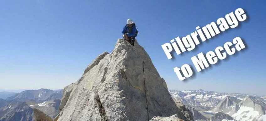
I’m drawing on my days in college as a Middle Eastern Studies major—one of the Five Pillars of Islam is that every Muslim with the means and ability to do so has the religious duty to perform Hajj, the pilgrimage to Mecca, at least once their lifetime. Likewise, as a climber and lover of the outdoors it is incumbent upon us to make the pilgrimage to Yosemite Valley.
Despite growing up on the West Coast, we never made it further south than California’s Redwood National Park in our outdoorsy pursuits. Yosemite looms large in the imagination… El Cap, Half Dome, Tuolumne Meadows, Yosemite Falls… I finally got the chance to stand below some of these fabled icons, in the stomping grounds of John Muir.
I recently returned from a week-long trip in the High Sierras, and while we only passed through Yosemite (no climbing in the valley… not yet!), we did have a pretty jam packed week.
We got in a quick backpacking trip up to Bishop Pass, cragging in the desert at Benton, climbing Mount Conness (12,590’) via the North Ridge (III 5.6), a basic rock rescue skills day, and climbing Bear Creek Spire (13,720’) via the Northeast Ridge (III Class 4—with sections of mid-fifth class).
It was a truly awesome week in the outdoors that leaves me longing for more of California’s beautiful granite ridge climbs and sunny weather.
En Route to Yosemite Valley
Friday I took off from work a few hours early to hop on the shuttle bus bound for Baltimore Washington International Airport. It had been a hectic week in the office with many hours spent on the House Floor, so I was REALLY looking forward to an extended trip in the mountains!
My flight left BWI at 7pm, and we landed five hours later at SFO at 10:15pm local time. My buddy Brett who I’ve climbed in the Cascades with on both Baker and Rainier had recently moved from Seattle down to San Francisco to work for Facebook and he was the one who actually talked me into coming down to the Sierras…
It hadn’t really been in my immediate plans, but the prospect of California weather versus the Cascades in June with loads of snow, damp tents and gear, and what would most probably be foul weather started sounding pretty good in comparison! Brett met me at the airport and we left immediately, headed for Yosemite Valley.
Fast forward four hours when we pulled into the Valley at 2:30 in the morning… We luckily were able to snag a campsite reservation for a Friday night at the Lower Pines Campground. Driving into the Valley we really couldn’t see much of anything in the pitch dark, everything was shrouded and remained a mystery for the time being.
I slept on the plane, but my body was set on East Coast time—5:30am. Time to sleep… We gathered all our scented items and threw them into bear lockers at the campsite and crawled into the bed of his truck also known as the (Toyota) Tacoma Lodge.
Waking up Below Half Dome
Saturday I staggered out of the truck at around 9am and was floored to see Half Dome just… right… there! Our site (Lower Pines #18, FYI) was situated, by luck, right on the edge with a perfectly unobstructed view of the face of Half Dome. I gawked for a while before we re-situated our belongings and headed off in search of coffee and breakfast.
Now, a summer Saturday in the Valley is probably about as busy as it gets, but throw in National Get Outdoors Day and free entrance to the Park and you’ve got some SERIOUS crowds.
Heading to the Valley Visitor Center wasn’t unlike finding parking at Wal-Mart. They even had a shuttle to take you from the parking lot to the actual Visitor Center, though we just walked. We went to Degnan’s for breakfast sandwiches and some coffee with a view of Yosemite Falls.
[singlepic id=149 w=540 h=405 float=center]After breakfast we made our way back to the car and headed for El Cap. The crowds thinned out almost immediately, and we pretty much randomly pulled over and grabbed parking just a short walk from El Cap.
It’s difficult to describe staring up The Nose and this famous chunk of granite… It’s just… really… big. 3,000 feet of granite? It’s difficult to even comprehend what it would be like to climb that.
It’s Seneca times 10!
But it’s very humbling to be in the birthplace of modern rock climbing—where all the greatest climbers have honed their craft from the days of Warren Harding and Royal Robbins, to Lynn Hill, to today’s climbers like Alex Honnold, Dean Potter, and Tommy Caldwell.
We hung around for a little bit watching a few parties on the wall, dragging up their haul bags (or pigs as their known), and slowly working their way up, adrift in a sea of granite.
If you’re heading to Yosemite, don’t miss out on this great guide to Yosemite National Park.
[singlepic id=153 w=540 h=405 float=center]Before too long we were back on the road, making our way out of the Valley and driving up and over Tioga Pass. We had discussed possibly setting up some top rope climbs in Tuolumne and even stopped at Lembert Dome to take a look, but ultimately just decided to push on to Bishop and try to get up to altitude.
Cresting the pass, we began descending into Owens Valley, which is a dry, arid desert. Though I guess it wasn’t always so. Los Angeles obtained much of its water from the Owens Valley to fuel its growth in the early 20th century.
William Mulholland and others worked in licit and sometimes illicit ways to obtain the water rights, which precipitated the California Water Wars. Today, fully half of Los Angeles’ water comes from the Owens Valley. I find it all quite fascinating and am now looking forward to picking up the book Cadillac Desert: the American West and Its Disappearing Water in order to learn more about the history there.
[singlepic id=154 w=540 h=405 float=center]Acclimatization: Onward and Upward to the High Sierras
We made it into the town of Bishop by about 4pm. Bishop is a small town, whose elevation at 4,147 feet is greater than its population of 3,879 people.
The town is particularly famous amongst the climbing community as it has easy access to desert sport climbing, an almost endless amount of high alpine granite, ample bouldering in the Buttermilks, not to mention nearby ice climbing and world class skiing in the winter, couple that with California’s awesome weather and you can see that makes Bishop a pretty tough place to beat.
I understand that in the winter it is fairly popular to go get in a half day of skiing up at Mammoth and then go sport climbing in the desert in the afternoon… a so-called dual sport day.
[singlepic id=155 w=540 h=405 float=center]In Bishop we picked up a few items from Wilson’s Eastside Sports, grabbed dinner at a little Mexican restaurant, and then picked up our backcountry permit from the Forest Service ranger station.
We wanted to get the acclimatization process started and so we headed up to the South Lake trailhead (9,800’), nearly 6,000 feet above Bishop, from there we hiked in about two miles to set up camp beside Long Lake (10,800’). You could definitely feel the altitude up here.
We had made a pretty sudden ascent, considering that only the night before we were camped at about 4,000 feet in Yosemite Valley. Besides a general shortness of breath, I wasn’t feeling any adverse affects at this point.
[singlepic id=156 w=540 h=405 float=center]Sunday morning we were up and the trail by about 9:30am for the 4 mile hike up to Bishop Pass (11,972’) and which marks the border of Kings Canyon National Park. Prior to this, my high point had been about 11,100’ at Camp Hazard on Mt. Rainier, where we got turned back because of weather.  The landscape on the hike, as you can imagine, was quite stunning—and despite the altitude the hiking itself is all pretty easy, with amazingly well maintained trails, very benign grades, soft dirt trails under foot, and lots of switchbacks (or pretty much the opposite of trails on the East Coast!).
We made the Pass by 11:30 where we hung out for a snack break and analyzed a possible route up Mount Agassiz (13,893’ Class 2) just to our east. Mount Agassiz was the easiest of the 40 climbs in Peter Croft’s excellent book The Good, The Great, and The Awesome.  From our vista at Bishop Pass it looked like a bunch of loose rock and scree, which would definitely not be fun… But we decided to get a closer look and rock hopped our way to the base.
Turns out, the rocks are all pretty stable, just massive hunks of rock that you need to pick your way up and over. You may have to use your hands in a few places, but it’s not often necessary. We made our way up to about 12,500’ however Brett was feeling the altitude with some dizziness and wasn’t into clambering up the boulder field, so we turned around at that point.
I also realized I had a small headache too, and with another 1,400’ of boulders, turning around was certainly the best call. If I were to do it again, I would shoot for a two night trip for lowlanders (i.e. sleep at the trailhead on night one, hike into somewhere below Bishop Pass to camp, then climb Agassiz and hike out).
Mammoth Lakes: Crystal Crag and Mammoth Crest
[singlepic id=159 w=540 h=405 float=right]With our early turn around on Agassiz, we were able to break camp and hike back out to the car by 4:30pm. We headed back out through Bishop and then made our north up to Mammoth Lakes. We got some food for making quesadillas and then pulled into the Lake George Campground situated at 9,100’. We had a view of the lake and of Crystal Crag (10,500’) looming above.
Monday morning we headed back into town for a real breakfast at the Stove and discussed our plans for the remainder of the trip. The next day we would be meeting up with our guide Ian McEleney from the American Alpine Institute for five days of climbing—we had come up with a few ideas but both Brett and I have been so busy at work that we weren’t able to put much thought into our climbing objectives.
We had a plan in place to head up to Mount Sill and Temple Crag, but we weren’t sold on that by any means. Brett wanted to take the day off to continue planning and get some of his gear in order, so I opted to do a little solo hike that day.
I headed out from Lake George that morning at 10am with plans for us to reconnect at 4pm. I hiked the few miles up to Crystal Lake and up toward Crystal Crag with the intent of scrambling up to the top via the descent route. With Peter Croft as my guide, and not really knowing which way to go beyond a general direction, I made my way up the boulders at the base.
There were a few gullies that looked viable, so I just picked one and headed up… I eventually stumbled across some cairns and a really loose, dirty, scree filled chute. I really wasn’t into the whole one step forward, two steps back approach, essentially post-holing in dirt, and began to become concerned about descending…
I sat down in a little notch off to the edge for a snack break when I decided that it just wasn’t worthwhile… I headed back to the base of the Crag and made my way over to the climber’s route, a nice looking 5.7, just to get a closer look. I hung out for quite awhile and enjoyed the view of the numerous lakes below.
[singlepic id=160 w=540 h=405 float=right]At around 1:30 I made my way back to Crystal Lake and reconnected with the trail. From there I decided to hike up the other direction up toward Mammoth Crest. The trail was amazingly moderate, as I had now come to expect, although there was a section with a great deal of storm damage that caused some difficulty in finding the other side of the trail.
The trees begin to thin out and you wind your way up to this red, volcanic remnant known as the Cinder Cone. The views from there are outstanding with Crystal Crag, the lakes, the rocky cliff band of Mammoth Crest, and Mount Banner and Mount Ritter in the distance. I slowly made my way back down the trail in order to meet up with Brett at 4pm.
[singlepic id=164 w=540 h=405 float=center]He got a hotel room back in town, and while I wasn’t against a camping intensive week, it was definitely nice to take a shower for the first time since Friday. We hit up Whiskey Creek for dinner and then made our way to the Clock Tower where we were supposed to meet up with Ian that evening to finalize our plan.
But we waited, and waited, and he still hadn’t showed? Brett got a text message that he was just on his way out from a previous trip and wouldn’t be able to make it… Hmm, so Temple Crag it is? Later that evening they were able to connect on the phone and discussed a possible change of plans.
Indecisiveness on Brett and I’s parts would be the theme for the trip, and to Ian’s credit he was able to embrace it and worked through it with us at each step of the way.
I was particularly concerned about hopping on some big 12-pitch, 5.7 climb out here (Temple Crag), since I didn’t know how hard a 5.7 would be (coming from the sandbagged Seneca grades), nor really what type of climbing to expect; and Brett wanted to minimize long approaches and our time spend hiking during the five days. Thankfully, there are just soooo many options for climbs out there, and having the flexibility to change things is great!
Climbing at Benton
Tuesday morning we met up with Ian outside the Looney Bean with a somewhat vague idea of possibilities and a rough plan. Ultimately we decided that the best bet today was to just get out and get some climbing in… That way I could get a feel for the grades and what I could climb out here (I’ve just been climbing easy stuff lately as I’m getting into trad leading) and Brett could get back on the rock, after nearly a year-long hiatus.
We headed out of Mammoth and back down into the Owens Valley, bound for Benton, a little desert crag located near the town of Benton. We headed down a long, dusty, dirt road, and pulled up below these single-pitch rock formations, that are apparently quite reminiscent of the rock climbing in Joshua Tree.
The approach is only a few minutes and can be done in sandals. The climbing is all trad, but there are (at least some) bolted anchors up top. Ian set up a progressively harder series of climbs. We started on an easy 5.4. The rock was amazingly rough and sticky—I felt super secure with all my feet and it was just good, fun climbing.
We did a quick mock multipitch route (5.6) to make sure everybody was on the same page. Then he set up a couple slightly harder climbs, maybe a 5.7 and then a really balance-y 5.9. I was pleasantly surprised that I was able to able to make it up the 5.9 cleanly—since I’m not a 5.9 climber!
[singlepic id=165 w=540 h=405 float=center]As a fair-weathered Northwestern’er, the desert heat and sun was really getting to me at this point… Not to mention the dehydration, having only drank two liters of water. [singlepic id=166 w=540 h=405 float=right] Ian set up another longer 5.6 climb, but I wasn’t feeling up for it, and was eagerly looking forward to a Gatorade. We left the crag by 3:30, bound for Mammoth Lakes, where Ian lives.
He gathered up his gear, and we gathered up some last minute supplies in town and then we all piled into the cab of Brett’s truck for the trip north. The plan as it stood now was to head for Mount Conness, do a car-to-car climb tomorrow, and then make a final call of whether to head up to Temple Crag or head to Bear Creek Spire following Conness.
We grabbed dinner at a gas station on the way—but no, this is no ordinary gas station, this is the Mobil Restaurant. I have never been to a gas station quite like this—a full service restaurant with fancy food, and outdoor dining overlooking Mono Lake. Quite awesome—the jambalaya gets high marks from me.
Mount Conness: Car to Car Climb
We drove all the way up to Saddlebag Lake and Ian and Brett were both astounded at the water level in the lake, neither had ever seen it so low. The water barely was reaching the base of the dam, apparently a victim of the low snow year in the Sierras. The highest campground up adjacent to Saddlebag Lake was still closed so we made our down a little lower to another campground located around 9,500’.
Wednesday morning we were up a little after 5am, and Ian was cooking up some really, really awesome breakfast burritos. Basically he just fried up a little bacon, and then fried up sweet potato chunks, and scrambled some eggs in with that. We had some Tapatío, pico de gallo, and cheese leftover from the quesadillas, and just throw all that into a tortilla… Delicious! The sweet potato gives it an awesome flavor and is certainly something I want to try again.
[singlepic id=167 w=540 h=405 float=center]We drove up to Saddlebag Lake and were on the trail by 6:30am—cross over the dam and weave around the edge of the lake. At one point we saw a four deer jump into the lake and proceed to swim across to the other side—quite a funny sight.
From Saddlebag you end up angling up a small series of ledges, though some beautiful alpine meadows, and past a number of small lakes. The total approach is about 4 miles.
We topped off our water bottles with three liters at one of the last lakes and ascended some loose, rocky scree and utilized a snow chute to access the ridge. After crossing through some more snow fields we eventually gained the ridge proper. The route starts off as a simple walk along a rocky ridgeline and then gradually ramps up in angle from 2nd class, to 3rd and 4th class, up to mid 5th class rock climbing.
[singlepic id=170 w=540 h=405 float=center]There are a series of small notches that you climb and then descend. The exposure gradually increases and Ian threw in some short sections of 5.7 or so climbing to keep us on our toes. It was just fun climbing, where you are gradually gaining ground, nothing too grueling that’s going to get you pumped, but it’s real alpine climbing.
At one point we were basically grabbing the tip top of the ridgeline and starring down the sheer drop down to the Conness Glacier hundreds of feet below. We were on the summit at about 2:30pm (8 hours later), where we signed the register, snacked, and hung out for half an hour.
The view is phenomenal, and the summit ridgeline actually marks the beginning of Yosemite National Park. You can see Half Dome off in the distance, as well as numerous other recognizable peaks.
[singlepic id=173 w=540 h=405 float=center]We switched our rock shoes for boots and began the descent along the opposite ridge. It’s all a pretty easy rock hop down the ridge with a few patches of snow. Lower down we found the notch along the ridge that would provide access to the snow field below, from there we could reconnect with the trail alongside the lakes and hike out the way we came in.
The snow conditions were okay, there was a hard crust a few inches down on some aspects, and I will say that I had a terrible time descending in my old hiking boots…
I don’t yet have a lightweight pair of mountaineering boots, so I just brought my Lowa hiking boots (Renegade Mid GTX). They are NOT particularly secure on snow—mountaineering boots have a nice, hard, sharp edge on the heel that provides good purchase while plunge stepping, whereas my hiking boots have a softer sole and rounded/tapered back edge which basically makes me feel like I’m going to fall while plunge stepping.
I spent most of the time inadvertently in a standing glissade, side-stepping and self belaying the other half, and fell on my butt a couple times.
[singlepic id=177 w=540 h=405 float=center]We eventually made it back to terra firma, which made me very happy. The hike out along the lakes was easy going and uneventful, except for the mosquitoes which seemed to have an inordinate focus on me and not my trail mates… At Saddlebag I decided to book it and hiked out ahead to see if I could try to outrun the mosquitoes. We were back at the truck by 6:30pm—12 hours car-to-car.
Decisions, Decisions: Bear Creek Spire or Temple Crag?
We stopped by the Mobil Restaurant once more for burgers and then made our way back to Mammoth Lakes. Brett and I dropped off Ian and made our way to the Shiloh Inn, we made plans to meet up with Ian at 9am for gear check and promised a final answer on where we would be spending the next three days…
We could hike into Temple Crag and get in one big climb (Venusian Blind Arete, 5.7 VI) or could head to Bear Creek Spire with the option of doing the North Arete (5.8 III) and/or the Northeast Ridge (Class 4 III). We decided that a big, grade VI climb with twelve pitches might be biting off too much to chew, so we settled on Bear Creek Spire where we’d have options for something more moderate.
Thursday morning, after a continental breakfast at the hotel we headed out to Ian’s place where we did a final gear check and ironed out the details of our plan… We would forgo an attempt on the 5.8 North Arete and stick to the Class 4 Northeast Ridge, and we’d add in a day of basic rock rescue instruction.
[singlepic id=178 w=540 h=405 float=center]We stopped by the ranger station on the way out of Mammoth for our permit and drove out to Tom’s Place. We finally got on the trail around noon. The first three and a half miles is all on easy trail, but at Gem Lakes you go off trail up a bunch of talus.
The going slows considerably as you hope from boulder to boulder, hoping you don’t step on a loose one, all while donning the heavy pack. We arrived at the edge of Dade Lake (11,600’) by 3:30pm where we would make camp for the next two nights.
It was a scenic location with the mostly frozen lake adjacent to camp and Bear Creek Spire towering another 2,000’ above. There are numerous sites along the lake that have had intricate wind walls piled up, I didn’t bring my MLD TrailStar (a five-sided tarp) because I was concerned about being able to stake it out in the rocky ground, but I think it would have been just fine.
Instead we shared Brett’s Bibler tent. At camp we did some basic rope and knot work—various hitches, cloves, munters, munter-mules, etc—to ensure we had those skills in the toolbox before our day of rock rescue skills. At dinner we had some strange looking cloud cover and could hear thunder in the distance… There was a chance of rain this evening, though none materialized, with a slightly hire chance tomorrow.
Rock Rescue Skills Day
Friday morning we were up at 8am, though Brett had a terrible night trying to sleep on account of my snoring, I guess. I’m not typically a snorer—or at least I haven’t had complaints from other tent mates—so I’m not sure if this was something attributable to the altitude or the dry, arid climate messing with my sinuses, but I certainly felt bad for him!
After breakfast we gathered our rock gear and made a quick 15 minute hike over to a small cliff where we could practice rock rescue skills. We went through numerous scenarios for rock rescue, starting out as a belayer and ascending the rope up an injured leader with your ATC Guide and going on to acting as the leader and rappelling down to an injured follower.
It was all very helpful and essential tools to have in your toolbox as a climber. Personally, I love learning more about all the technical systems in rock climbing and that is one my favorite reasons to hire guides, being able to pick their brains and accelerate the learning curve, rather than just say “Hey! All I care about is getting to top of Peak X, set up my camp, bring me tea, tie all my knots for me, and drag me up!”
By mid-afternoon more ominous looking clouds begun amassing overhead so we packed up at the cliff and headed back toward camp in case the rain started coming down…
Soon thereafter we were joined by two other parties who were getting in position for their own climbs… Ah, yes, it was the weekend again.
We practiced a few other skills but mostly just hung out socializing. The rain never materialized, and the clouds eventually cleared. I gave Brett a break and decided to cowboy camp at the boulder bivy, a slightly overhanging boulder with a large wind wall built of rocks, which was big enough for one person.
I laid out parts of my CiloGear 60L pack and flaked the rope out below my Neoair sleeping pad to help protect it from the rocks. We gathered our gear for tomorrow’s climb and we were to bed relatively early. My boulder bivy was surprisingly well protected from whatever light wind we had, and with my earplugs in I got a great night’s sleep.
Climbing the Northeast Ridge of Bear Creek Spire
I was up at 4:30am, scarfed down some oatmeal, re-coiled the rope, and remembered to grab snack foods, sunscreen, etc from the bear canister before setting out at 5:30am. There would be more snow on this route than on Conness, and we hit the snow right on the opposite side of Dade Lake.
After my slip-slidey descent on Conness, I decided to bring my Yaktrax for a little added traction. The snow was rock solid at this early morning hour, so I quickly put on my Yaktrax and they made a huge improvement over just my hiking boots on the approach.
We passed through a series of snow bowls with intermittent rock bands before gaining the Northeast Ridge. The climb was similar to Conness, in that it starts with benign ridge walking that gradually steepens into more exciting rock climbing, but differs in that there is less horizontal ground to cover and is more straightforward and direct without needing to rappel or down climb any notches.
[singlepic id=180 w=540 h=405 float=center]The route apparently can be a class 4 climb, though I really don’t understand how that is the case. We stayed closer to the arête along the climb which brings in some mid fifth class climbing, but it seems that any way you go would include at least some fifth class. Peter Croft even characterizes the summit block as an “exposed and burly class 4” which has relatively small hand and footholds and feels like real climbing to me, ") so I guess I just don’t understand the dividing line… It was again all pretty awesome climbing with gradually growing exposure, though not as airy as Conness until you gain the last bit of the ridge.
so I guess I just don’t understand the dividing line… It was again all pretty awesome climbing with gradually growing exposure, though not as airy as Conness until you gain the last bit of the ridge.
That’s when it gets really fun and exciting. Indeed, the summit block itself is about the size of a pizza box, just large enough for one person. Ian put in a few pieces of protection and then let us take turns climbing up to the summit (13,720’) which we topped out on at about 10:30am (five hours from camp).
[singlepic id=196 w=540 h=405 float=right]Ian lowered us off the summit area back down to a chossy, rocky descent along the shoulder. We made it to a notch where we descended back into the snow. I put my Yaktrax back on at this point, though the snow had softened up considerably and made for a much more sure-footed descent than on Conness a few days earlier.
It was a little sketchy in the beginning when we encountered a large section that had ice below the snow, but once we cleared the rocks below we were able to unrope and just sit on our butts to glissade down the mountain… It doesn’t get much easier than that!
We’d slide down a few hundred feet until the slope mellowed and forced us to walk again, and would arrive at one of the subsequent snow bowls and glissade again! We were back at camp at 12:30, two hours after the summit—very cool. We basked in the sun at camp and let ourselves dry out a bit from rolling around the snow. We had to break camp at this point and pack up, hitting the trail again by 3pm.
[singlepic id=192 w=540 h=405 float=center]The hike out always seems to drag on, but Ian was giving me his thoughts on my upcoming dirtbag adventure and had lots of guide ideas on outfitting the bed of a truck for extended travel, places that one should definitely check out (like Joshua Tree), and sound recommendations like taking a Wilderness First Responder (WFR) course.
We made it out to the car by 5:30pm and headed straight down to Tom’s Place for some monster hamburgers. We made it before Peter Croft ate them all—Peter Croft frequently talks about hamburgers and fries in his book The Good, The Great, and The Awesome, so it became a running joke on the trip that we needed to climb faster, climb better, or Peter Croft would eat all the hamburgers.
We dropped Ian back off at his house and said our goodbyes. Ian was an awesome guide, and comes with a high recommendation from me—he knows his stuff, of course, but is also just a fun guy to hang out with in the mountains for days on end, and has a great deal of experience and knowledge of the Sierras. Brett and I headed out to the Alpenhof Hotel and then went and hung out at the Clock Tower before turning in for bed early.
Back to Reality
Sunday morning we gathered our gear, checked out of the Alpenhof, and headed to the Breakfast Club for some awesomely delicious huevos rancheros and coffee. We made a pit stop at Mammoth Mountaineering, and while I wasn’t in need of any gear it’s always fun to look.
Sometime after noon we started slowly making our way back to San Francisco. My flight wasn’t until 11pm—red eye, sweet—so we weren’t in any big hurry. We drove up to June Lakes, Virginia Lake, popped by Mono Lake and spent some time at the visitor center, continued on through Lee Vining and on up north to Sonora Pass.
Sonora Pass is another gorgeous drive, and it looked like there was a lot of great rock to climb up that way as well—that’s the problem with the Sierras, every turn you come across more great rock that you’d love to climb, alas a week is only enough to get a little taste, but I’m sure glad that I went down there… I look forward to returning.
[singlepic id=193 w=540 h=405 float=center]We made it back to SFO by 8pm, I boarded my flight back to DC and slept all the way, landing at 7am. Unfortunately the shuttle had to fight the morning traffic from BWI all the way back into DC, but I showered, shaved, and then headed off to work—back to reality.
Gear Comments
- My summit pack on Conness and Bear Creek Spire was a Mountain Laurel Designs Burn which was more than enough for the day trip. I could attach my ice axe and keep all gear accessible in the large exterior pocket. My big pack was my CiloGear 60L, which again is bigger than needed for these short trips, but it could easily fit a bear canister along with the other gear.
- Feathered Friends Jackorack windshirt proves its usefulness again, it gave me a great comfort boost at belays and buffeted against the wind. It is pretty much always in my pack or on me for every trip.
- My hiking boots (LOWA Renegade GTX Mid) were a disappointment on steeper snow, but the Yaktrax for their weight and size greatly enhanced my sure-footedness on the snow.
High Sierra Trip Details
Trip: Private Guided Trip in the Sierras
Guide: Ian McEleney with the American Alpine Institute
Dates: June 12 – June 16, 2012 (5 days guided) – Overall June 9 – June 17 (9 days)
Price: $1,300 (per person for a group of two)
Ryan
Latest posts by Ryan (see all)
- Kazakhstan Food: Exploring Some of its Most Delicious Dishes - August 7, 2023
- A Self-Guided Tour of Kennedy Space Center: 1-Day Itinerary - August 2, 2022
- Fairfield by Marriott Medellin Sabaneta: Affordable and Upscale - July 25, 2022
- One of the Coolest Places to Stay in Clarksdale MS: Travelers Hotel - June 14, 2022
- Space 220 Restaurant: Out-of-This-World Dining at Disney’s EPCOT - May 31, 2022